ASTER
Overview
The Advanced Spaceborne Thermal Emission and Reflection Radiometer (ASTER) global DEM dataset is a joint effort between the Ministry of Economy, Trade, and Industry (METI) of Japan and the National Aeronautics and Space Administration (NASA) of the US.
ASTER GDEM is a 1 arc-second resolution, corresponding to a resolution of about 30m at the equator. Coverage is provided from from -83 to 83 degrees latitude.
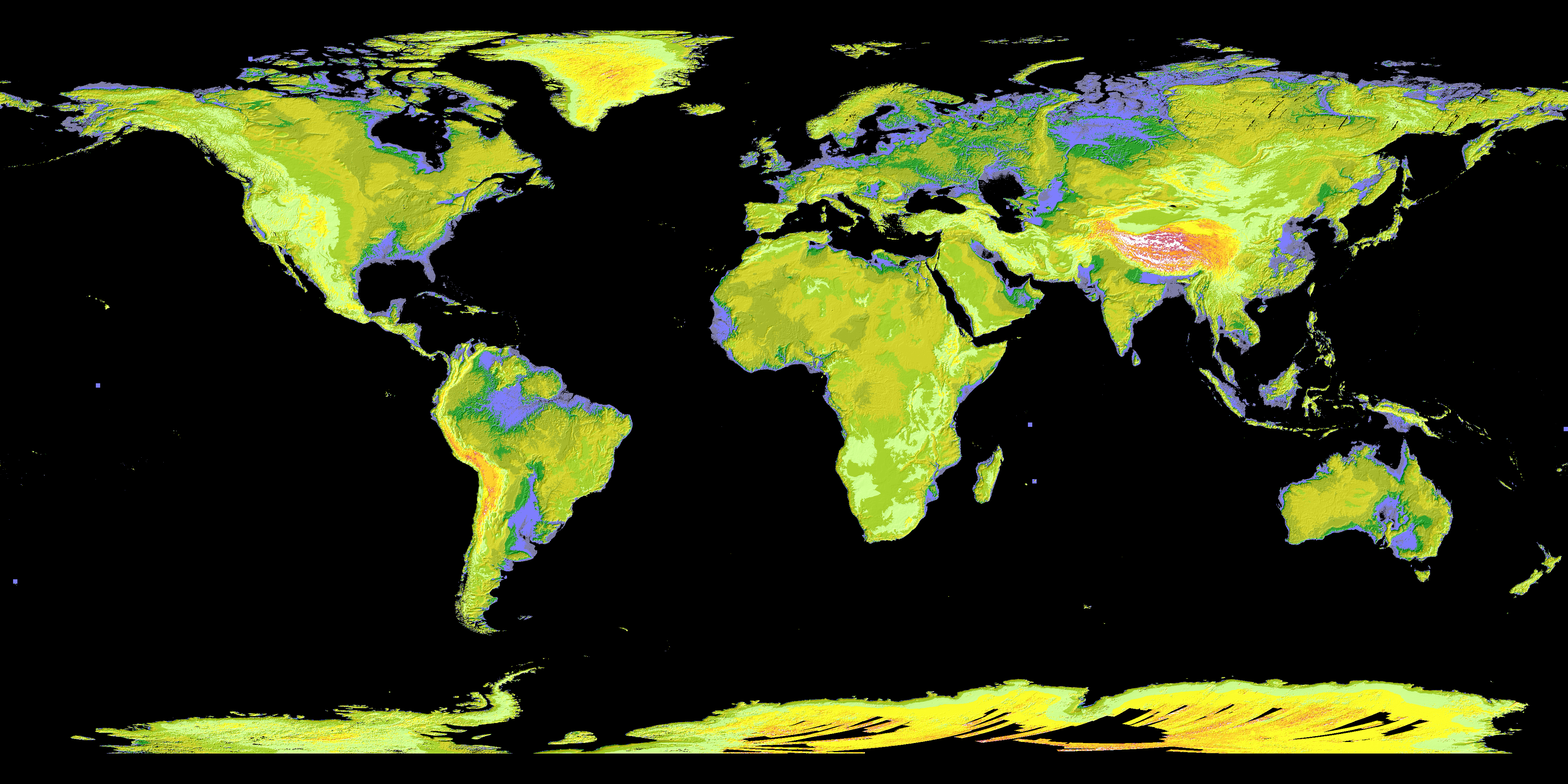
Render of ASTER elevation. Source.
Adding 30m ASTER to Open Topo Data
Make a new folder for the dataset:
Download the files from USGS into ./data/aster30m . Extract the zip archives keeping the _dem.tif files and removing the _num.tif files.
To make downloading a bit easier, here's a list of the 22,912 URLs: aster30m_urls.txt.
Create a config.yaml file:
Rebuild to enable the new dataset at localhost:5000/v1/aster30m.
Public API
The Open Topo Data public API lets you query ASTER GDEM 30m for free:
{
  "results": [
    {
      "elevation": 45.0,
      "location": {
        "lat": 57.688709,
        "lng": 11.976404
      },
      "dataset": "aster30m"
    }
  ],
  "status": "OK"
}
The Public API uses version 3 of the DEM (GDEM 003).