GEBCO 2020 Bathymetry
GEBCO maintains a high-quality, global bathymetry (sea floor depth) dataset.
GEBCO releases a new dataset most years, the 2020 dataset (released in May 2020) covers the entire globe at a 15 arc-second resolution, corresponding to 450m resolution at the equator.
Coverage
Elevation is given for land areas, largely using a 15-degree version of SRTM.
Seafloor data comes from a variety of bathymetric sources, see GEBCO for more details.
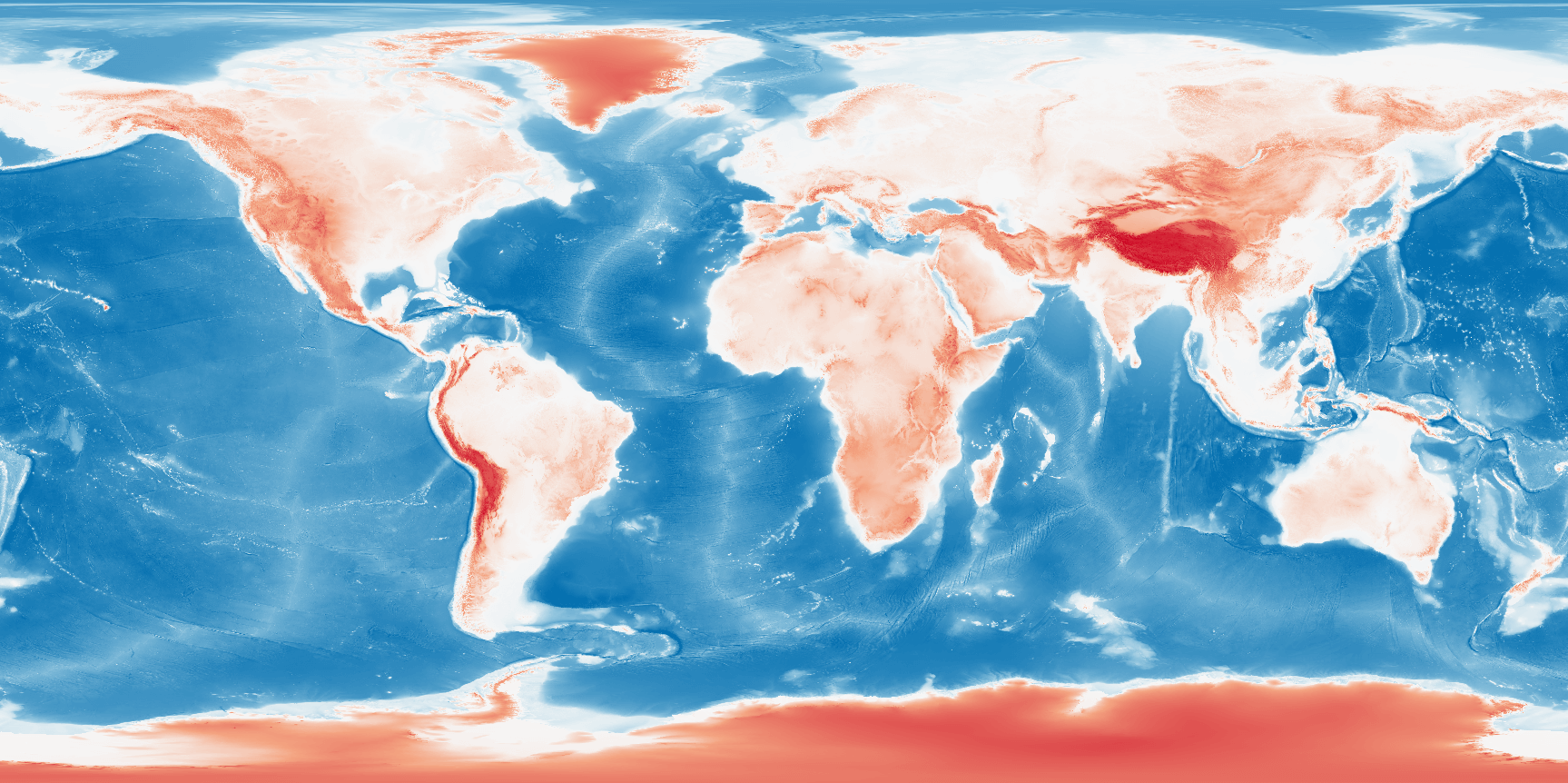
Render of GEBCO 2020 elevation.
Adding GEBCO 2020 to Open Topo Data
Instructions are given for the 2020 version of the dataset: future versions might work a bit differently.
Make a new folder for the dataset:
Download the dataset from GEBCO. You'll want the GEBCO_2020 Grid version, in Data GeoTiff format. Extract raster tiles from the archive and delete everything else so there are just 8 .tif files in the ./data/gebco2020 folder.
The files are given as 90 degree tiles, we need to rename them to SRTM's NxxSxx format to work with Open Topo Data:
mv gebco_2020_n0.0_s-90.0_w0.0_e90.0.tif     S90E000.tif
mv gebco_2020_n0.0_s-90.0_w-180.0_e-90.0.tif S90W180.tif
mv gebco_2020_n0.0_s-90.0_w-90.0_e0.0.tif    S90W090.tif
mv gebco_2020_n0.0_s-90.0_w90.0_e180.0.tif   S90E090.tif
mv gebco_2020_n90.0_s0.0_w0.0_e90.0.tif      N00E000.tif
mv gebco_2020_n90.0_s0.0_w-180.0_e-90.0.tif  N00W180.tif
mv gebco_2020_n90.0_s0.0_w-90.0_e0.0.tif     N00W090.tif
mv gebco_2020_n90.0_s0.0_w90.0_e180.0.tif    N00E090.tif
Create a config.yaml file:
Rebuild to enable the new dataset at localhost:5000/v1/gebco2020.
Buffering tiles
The tiles provided by GEBCO don't overlap and cover slightly less than a 90° x 90° square. This means you'll get a null result for coordinates along the tile edges (like 0,0).
For the public API I used the following code to add a 5px buffer to each tile.
from glob import glob
import os

import rasterio


old_folder = 'gebco_2020_geotiff'
new_folder = 'gebco_2020_buffer'
buffer_ = 5


old_pattern = os.path.join(old_folder, '*.tif')
old_paths = list(glob(old_pattern))

cmd = 'gdalbuildvrt {}/all.vrt'.format(old_folder) + ' '.join(old_paths)
os.system(cmd)

for path in old_paths:
    new_path = path.replace(old_folder, new_folder)

    with rasterio.open(path) as f:
        new_bounds = (
            f.bounds.left - buffer_ * f.res[0],
            f.bounds.bottom - buffer_ * f.res[1],
            f.bounds.right + buffer_ * f.res[0],
            f.bounds.top + buffer_ * f.res[1],
        )

        new_shape = (
            f.shape[0] + buffer_ * 2,
            f.shape[1] + buffer_ * 2,
        )

    te = ' '.join(str(x) for x in new_bounds)
    ts = ' '.join(str(x) for x in new_shape)

    cmd = f'gdalwarp -te {te} -ts {ts} -r near -co NUM_THREADS=ALL_CPUS -co COMPRESS=DEFLATE  -co PREDICTOR=2 -co BIGTIFF=yes {old_folder}/all.vrt {new_path}'
    os.system(cmd)
Public API
The Open Topo Data public API lets you query GEBCO 2020 for free:
{
  "results": [
    {
      "elevation": 3405.0,
      "location": {
        "lat": 37.6535,
        "lng": -119.4105
      },
      "dataset": "gebco2020"
    }
  ],
  "status": "OK"
}
The public API uses the 2020 version of the dataset.
Attribution
GEBCO released the dataset into the public domain under the following terms:
- Acknowledge the source of The GEBCO Grid. A suitable form of attribution is given in the documentation that accompanies The GEBCO Grid.
- Not use The GEBCO Grid in a way that suggests any official status or that GEBCO, or the IHO or IOC, endorses any particular application of The GEBCO Grid.
- Not mislead others or misrepresent The GEBCO Grid or its source.